In this article, I will explore different maps, satellite photos, and the Google Earth Alternatives. Even though Google Earth is practical, there are many other options available with extraordinary features such as offline access, GIS analysis, custom mappings, and real-time weather updates.
Whether for professional use or basic navigational needs, these solutions are great advanced geography tools and simple navigational aides.
Key Point Best Google Earth Alternatives for Exploring the World
| Mapping Tool | Key Features |
|---|---|
| NASA Worldview | Real-time satellite imagery, environmental monitoring, disaster tracking |
| Zoom Earth | Live weather updates, satellite imagery, hurricane and wildfire tracking |
| Esri ArcGIS Earth | 3D geospatial analysis, GIS data integration, urban planning |
| Marble | Open-source, offline maps, multiple map views, GPS tracking |
| Mapbox | Custom mapping APIs, real-time data integration, business applications |
| OpenStreetMap (OSM) | Open-source, editable maps, crowdsourced data, offline navigation |
| HERE WeGo | Turn-by-turn navigation, offline maps, public transit routes |
| Bing Maps | Aerial imagery, 3D views, business and navigation integration |
| Google Maps | Real-time navigation, Street View, traffic updates, business search |
1. NASA Worldview – Alternative of Google Earth
For users who need to keep an eye on the world, NASA Worldview acts as the ideal substitute option to Google Earth.
Users interested in satellite imagery and environmental monitoring will gravitate more towards Worldview than Google Earth.
NASA has developed Earth Observing System satellites equipped with high resolution cameras which can be used to monitor hurricanes, deforestation, and wildfires.
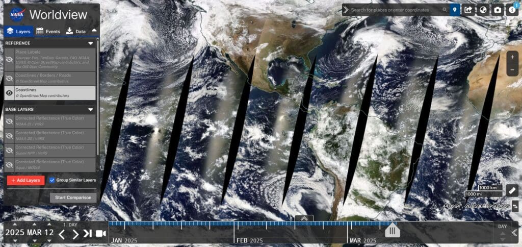
Coupled with interactive overlays and historical information, educators, policy makers and researchers can use WWII to track and study a variety of climatic changes.
Unlike Google Earth, Zoom Earth’s real-time weather tracking features make it more suited for studying the environment.
- Best for: Real-time satellite imagery and environmental data.
- Features: Access high-resolution satellite images
- track weather patterns, and monitor natural disasters.
- Ideal for scientists, researchers, and educators.
- Platform: Web-based.
2. Zoom Earth – Google Earth Alternative
Zoom Earth is the best substitute for Google Earth when it comes to real time updates on weather and satellite pictures.
While Google Earth features 3D mapping and street views, Zoom Earth uses information from NOAA, NASA, and other satellites to focus on tracking hurricanes, wildfires, and storms.
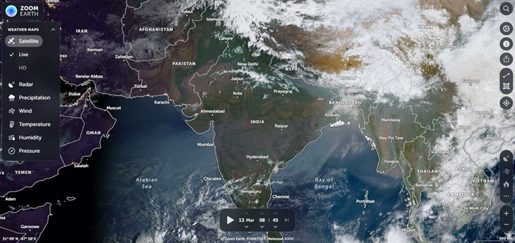
It is also helpful in tracking long term environmental changes due to its ability to compare historical imagery. Rather than using software, Zoom Earth is accessible online, meaning anyone can use it without installation.
Zoom Earth is arguably the best alternative to Google Earth for those focused on watching weather rather than viewing the 3D terrain.
Zoom Earth
- Best for: Fast and interactive global exploration.
- Features: Offers real-time weather overlays
- high-resolution satellite imagery, and a user-friendly interface
- Great for casual users and professionals.
- Platform: Web-based.
3. Esri ArcGIS Earth – Google Earth Alternative
Esri ArcGIS Earth has noted professional features Google tends to lack, including powerful Geographic Information System (GIS) functionalities for deeper geospatial analysis.
Unlike Google Earth and its superior visualization focus, ArcGIS Earth aims to integrate information from various databases for urban planning and environmental research.
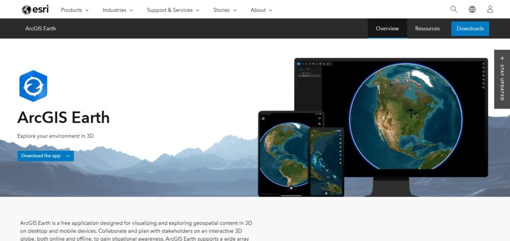
It is ideal for use by government employees and business and research professionals as it allows use of various file formats, including satellite pictures, shapefiles and KML, which is rare for such users.
Users are able to analyze landscapes, overlay maps, and add real-time data. For decision making regarding disaster management, land use planning, and environmental conservation, ArcGIS Earth provides powerful tools.
This makes it an amazing supplement to Google Earth’s regular mapping functionalities.
- Best for: GIS professionals and advanced mapping.
- Features: Create custom maps, analyze geospatial data,
- Integrate 3D terrain models.
- Supports KML files for detailed exploration.
- Platform: Windows, iOS, Android.
4. Marble – Google Earth Alternative
Marble is a virtual globe software that is open-source, which makes it a wonderful counterpart to Google Earth, particularly for those that require having access offline.
While Google Earth is mainly tethered to an internet connection for optimal feature accessibility, Marble breaks away from this barrier as it enables users to engage with maps and satellite images even in the absence of internet connectivity.
It has various map options, which consist of street maps, topographic maps, and even historical imagery.
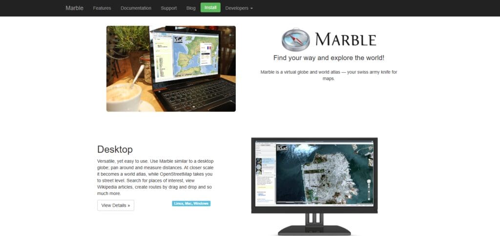
Additionally, Marble supports GPS tracking and route planning, making it beneficial to travelers, educators, and researchers.
Its lightweight versionsility across platforms makes it great for people looking for an effective, yet uncomplicated substitute for Google Earth.
- Best for: Open-source mapping and offline use.
- Features: A lightweight, open-source virtual globe with historical maps
- Weather data, and route planning.
- Works offline, making it ideal for travelers.
- Platform: Windows, macOS, Linux.
5. Mapbox – Google Earth Alternative
Mapbox is an advanced mapping platform that serves as a developer-friendly alternative to Google Earth.
Mapbox is another alternative to Google Earth, but with a greater focus on developers and the world of coding.
Unlike Google Earth that thrives on 3D exploration being as simple as it could be, Mapbox offers customizable APIs and SDKs for use with their platform, so developers can create interactive maps for mobile and web applications.
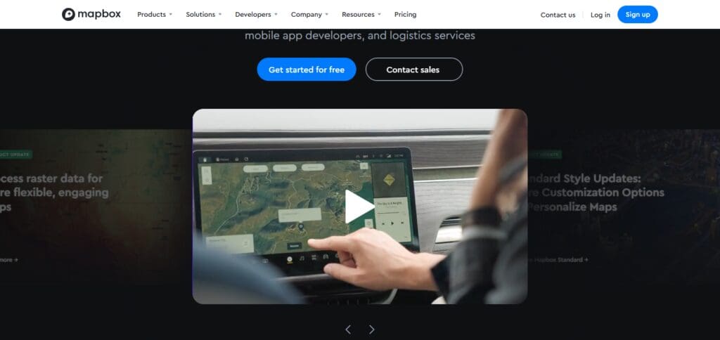
Many businesses utilize Mapbox for logistics tracking, geospatial analytics, and navigation services.
Strava and Snapchat make use of Mapbox’s services for their location-based services. It’ll help you visualize your projects with its satellite images, real-time data, and AI mapping tools.
It is an excellent alternative for developers and businesses who wish to create their own customized mapping solutions due to its high flexibility and customization options.
- Best for: Street-level views and aerial imagery.
- Features: Offers detailed street maps
- 3D cities, and bird’s-eye views.
- A solid alternative for navigation and exploration.
- Platform: Web-based, Windows.
6. OpenStreetMap (OSM) – Google Earth Alternative
OSM is diferently developed and maps can be edited and changed by users, So it’s considered community-driven.
It is an open-google earth alternative. It is not as elegant as other providers, but still remains a favorite resource for urban planning, humanitarian purposes and offline navigation, and also widely used in Maps.me, OsmAnd, and other apps for services.
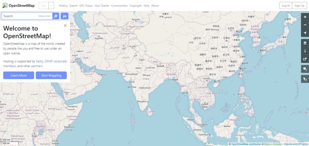
Its database is free to edit, which is why its open-source nature makes it a great alternative for users who want to remove the restrictions unlike commercial services such as Google Earth.
- Best for: Community-driven maps and customization.
- Features: A collaborative, open-source mapping platform with detailed global coverage.
- Ideal for developers and users who want to contribute to map data.
- Platform: Web-based, mobile apps.
7. HERE WeGo – Google Earth Alternative
HERE WeGo, unlike Google Earth Explorer, focuses on turning on the indoor navigation and step progression directions of a location, alongside measures such as using bicycles and casual walking on the streets.
It also provides traffic jam data, information on public transport options, and arrangements for walking as well as WeGo steps.
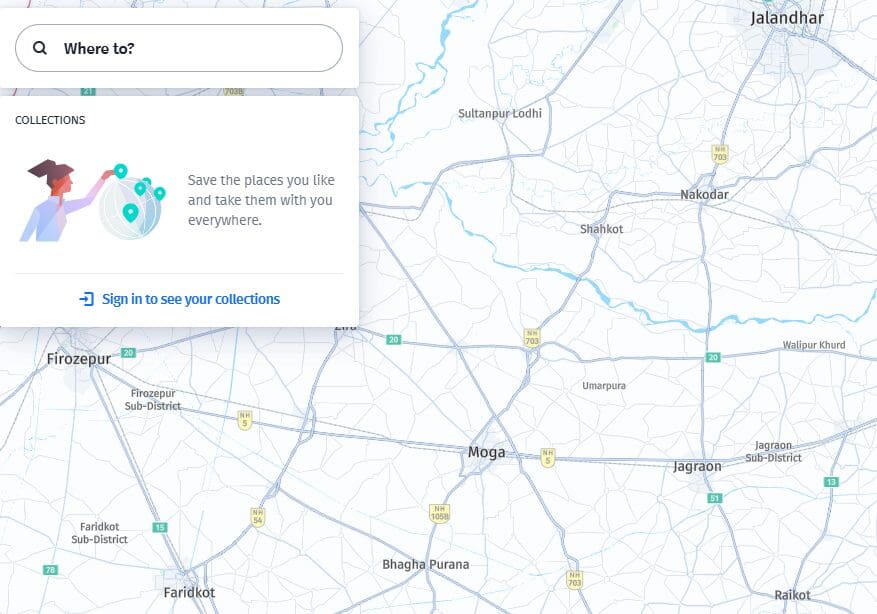
Those who travel a lot or work with maps to plan locales and zones offline may find HERE WeGo to be an excellent pick because of its unmatched offline functionality.
For those in need of precise mapping data with real-time updates, HERE WeGo serves as a marvelous alternative to Google Earth. Unlike people who are more into 3D exploration, those interested in navigation will make good use of HERE WeGo.
8. Bing Maps – Google Earth Alternative
Microsoft’s Bing Maps is definitely a strong rival Google Earth as now with Bing Maps you can have access to street maps, aerial imagery and now even detailed 3D views.
While Google leads in development with Earth, keeping their program centered around industrious exploration, Bing Maps has lost no ground and is, in fact, progressively advancing in navigation and business applications all while using other Microsoft features.
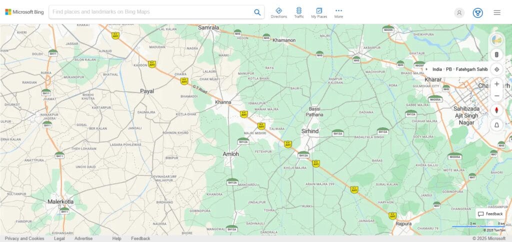
With Bing maps one can have direct access to integration of Microsoft services. Traffic updates, route planning, searches for local businesses – you name it, Bing Maps does it.
For developers, Bing Maps offer API services so that businesses can incorporate Maps into their applications.
All these features bundled with high-resolution and flawless direct from Microsoft imagery melts together Bing Maps with Google Earth as the best alternatives for personal or enterprise goals.
- Best for: Street-level views and aerial imagery.
- Features: Offers detailed street maps, 3D cities, and bird’s-eye views. A solid alternative for navigation and exploration.
- Platform: Web-based, Windows.
9. Google Maps – Google Earth Alternative
Most people indeed put Google Earth head to head against Google Maps. But it’s important to note; Earth is geared towards 3D active exploration and satellite view, whereas Maps centers around vehicle operations in real-time, business searches and planning of routes.
Adding to the flocks of features Google Maps provides; Street Views, traffic updates and even instructions on public transit systems are accessed adding to one of the most used features worldwide.
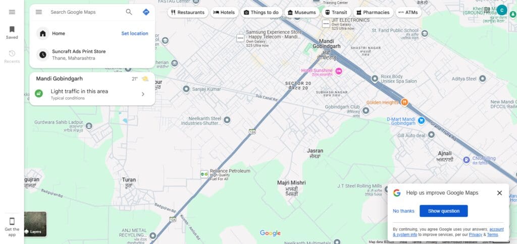
For those who want useful navigation features rather than just viewing geography, it serves as a wonderful substitute for Google Earth.
Google Maps is also widely preferred by developers due to its API support for location-based services, ride-sharing applications, and business directories.
- Best for: Everyday navigation and local exploration.
- Features: While not a direct Google Earth alternative, Google Maps offers Street View, 3D buildings, and detailed directions. Perfect for urban exploration.
- Platform: Web-based, iOS, Android.


